Earth’s final frontier
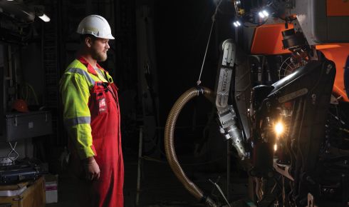
The ROV Aurora, launched as part of the Ocean Census: Arctic Deep expedition in Norway, 2024. Martin Hartley / The Nippon Foundation-Nekton Ocean Census
26 May 2025
The race is on to collect and synthesise data on Norwegian Sea ecosystems before deep-sea mining begins
In early 2024 the Norwegian parliament voted overwhelmingly to open its seabed for commercial mining of valuable minerals. This sparked fierce internal and international opposition, and while Norway’s Minister of Energy claimed that a “thorough process has been carried out with broad involvement”, by the end of the year one of Norway’s political parties had effectively blocked the move for “going against all environmental advice”.
The deep ocean floor contains vast deposits of minerals, particularly manganese, that are in high demand in renewable energy technologies. The government insists the political block is simply a postponement and that it has done the necessary groundwork to go ahead with mining. But with so little known about the deep sea, is it possible for any nation or institute to carry out the research necessary to make a call on how deep-sea mining can affect our oceans? If not, how do we fill these gaps in our knowledge?
Professor Torkild Bakken is part of the TripleDeep project, which aims to explore whether these minerals can be mined without causing massive and irreparable harm to the unique ecology of the deep oceans. “What we have said on different occasions, including at the Parliamentary Environmental Committee Hearing and in open hearings with the Ministry of Energy, is that we need an enormous range of data if we’re going to be able to answer any questions about how mining will affect the marine ecosystem,” he says.
Holes in the data
That lack of data is partly due to the deep sea being the least explored ecosystem on the planet. Deep-sea expeditions (usually considered to be anything deeper than 200m) are expensive and limited in range. And while there has been a lot of ecological research carried out in the Norwegian Sea in the last few decades, the majority has focused on the area around the coastal shelf and in the pelagic zone – nowhere near the seabed area that will be mined.
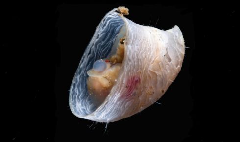 Discovering new ocean species, such as the cocculinid limpet (above) is fairly routine.
 Martin Hartley / The Nippon Foundation-Nekton Ocean Census
“There’s a huge gap in the openly available data – and that gap covers the area that Norway is planning to open for commercial deep-sea mining,” explains Laura Paiba García, a paleoecologist working with Bakken on the TripleDeep project. She is attempting to paint a picture of biodiversity on the sea-floor using data compiled from research expeditions stretching from last year to 1876. “We estimate that less than 2% of the marine biodiversity data we have access to in and around the Norwegian Sea is relevant for the deep sea. Most of that 2% forms an enormous ring around the zone that the government has proposed to mine. As of right now, we have no precise way of quantifying how badly deep-sea mining will damage marine life in the Norwegian Sea.”
In the 1850s, scientists believed that as you travelled deeper into the sea, life would eventually stop existing. Towards the end of the century, expeditions started trawling or dredging the deep seas and quickly disproved theories of a barren sea-floor. From the 1930s onwards, floating research stations were constructed in the Norwegian Sea, which enabled more regular sampling, eventually including the use of drop cameras, capturing the first images of life at previously unseen depths. The 1970s also saw the use of ‘sleds’ that were dragged across the sea-floor, a less destructive research method than dredging or trawling.
Yet it wasn’t until the development of remote-operated vehicles (ROVs) that our understanding of deep-sea biology really exploded. Suddenly, core samples could be taken from the seabed and transects could run to observe marine life, reporting images back to the surface in real time. Sea-floor samples could be taken for genomic sequencing, enabling us to record species simply from the trace DNA they’d left in the water and sediment. Human-occupied vehicles followed soon after, enabling first-hand observation of life deep under the surface.
Expeditions nowadays routinely stumble across new species, with a 2016 expedition into the Clarion-Clipperton Zone (CCZ) in the North Pacific finding that half of the species they collected were new to science. Earlier this year a study led by the Scottish Association for Marine Science found a potential new source of oxygen in the deep sea, which could even provide insights into how life began on our planet.
Deep biodiversity
Yet despite this progress, the deep sea covers more than 95% of the planet’s oceans and we have only a tiny fraction of that area mapped. The proposed mining area in the Norwegian Sea is roughly 280,000km², and while this sea was once thought to hold relatively little in the way of biodiversity, recent research has shown that it is much more topographically diverse than previously thought, filled with seamounts, valleys and plateaus, all of which make for a highly biodiverse region.
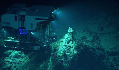 The discovery of new thermal vents is still taking place.
 Martin Hartley / The Nippon Foundation-Nekton Ocean Census
Our understanding of the impact of deep-sea mining is also poor, although what we do know is not encouraging. Disturbances on the deep-sea floor kick up enormous clouds of sediment that can blanket entire ecosystems. The effects of these dust plumes can also vary greatly depending on ocean currents, with even a small mining operation able to send plumes travelling tens of kilometres in certain currents.
Even more worrying is the timescale of potential effects. A new survey in the CCZ showed that 44 years after an initial mining collector test, the sea-floor still bears the (quite literal) scars of the machinery used.
The CCZ is similarly sought after by mining companies. It covers roughly 6,000,000km², almost two thirds of the area of the US. The area contains a vast supply of polymetallic nodules, a different resource from that of the manganese vents in the Norwegian Sea, yet no less prized by mining companies.
In 2012 the UN-founded organisation the International Seabed Authority led a long-term environmental impact assessment of the CCZ, which led to nine regions being designated as protected reserves that may not be mined. It was a result of decades of environmental monitoring using different techniques to look at a wide variety of taxonomic groups. Sediment sampling, visual observations using ROVs and extensive deep-sea trawling were all part of the research that made up the assessment.
Could something similar be done in the Norwegian Sea? “Absolutely,” insists Paiba García. “We know we need more biodiversity data, but we also know where we have gaps that we need to fill. The technology to allow this data collection is a reality now. We’ve seen it happen in the CCZ and it seems sensible and reasonable to carry out this research in the Norwegian Sea.”
Yet the CCZ is also a cautionary tale. In the years since the protected zones were established, environmental DNA sequencing has allowed for new analysis of sediment and water samples from the sea-floor. These new techniques, along with more comprehensive surveys, have demonstrated that the nine protected areas don’t adequately capture the variation within the CCZ and scientists have since suggested expanding these original areas.
It’s good to share
Our poor understanding of Earth’s last frontier is not just about the inaccessibility of the ecosystem in question. A large proportion of the data we do have from the deep sea is still widely unavailable to anyone trying to look at the bigger picture.
Some of this comes down to new technologies and data systems being slow to spread. Institutions such as the Global Biodiversity Information Facility and the Ocean Biodiversity Information System make it possible to share data easily with the rest of the scientific community, but require a working knowledge of data science.
Yet even where the means to share data exists, the will is not always there. Scientists can be more interested in keeping their data behind closed doors to produce as many interesting publications as possible – boosting their own profile – before sharing it. It means data that could potentially fill holes in larger studies goes unpublished and large ecological surveys are left incomplete.
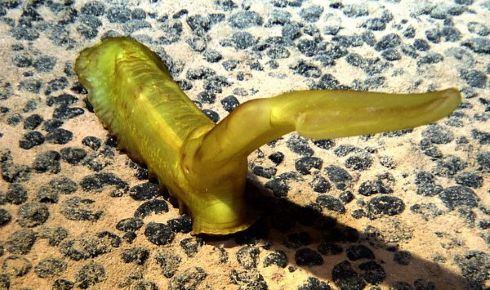 The effect of deep sea mining on species including this sea cucumber (psychropotes longicauda) is not yet fully understood.
 Martin Hartley / The Nippon Foundation-Nekton Ocean Census
Progress is being made on this front. Data science has become a more standard skillset for ecologists and the increased cooperation between institutes that we’ve seen building over the last few decades has made data sharing more commonplace. AI is beginning to play a role too, with new tools enabling the arduous process of formatting data for upload to a standardised global database to be done automatically.
Even with data accessibility slowly but surely increasing, is it realistic to expect scientists to be able to paint a detailed enough picture of the Norwegian Sea floor to enable informed decision-making on the mining process?
“There are a few sites where we have some detailed analysis,” explains Bakken. Loki’s Castle was the first vent field of its kind discovered in the region and it’s been the focus of much research ever since it was found in 2008. It took until last year for a comprehensive fauna inventory to be published. Fifteen new species were discovered and the study showed the vent fauna in the area was vastly different from similar habitats in other oceans. But is this a detailed enough study to understand the effect of potential disturbances to the ecosystem?
Bakken is optimistic, but cautious. “Loki’s Castle is a great example of the type of research we need, but at the moment it’s not enough. The area is only 300m², and with the sort of topological diversity we find around vents such as Loki’s Castle, it means if you travel just an extra 100m, the environment and the fauna could change completely.”
A model approach
Sampling the entire seabed is unrealistic, but creating models based on carefully planned data collection is possible, says Marine engineer Harold Horsley, who is attempting to map life in the Norwegian Sea based on our understanding of ocean dynamics.
“What we’re trying to do is model life beneath the surface by harnessing physical phenomena we can reliably predict, such as ocean currents and salinity fields, and using them to generate maps of ocean life,” he explains. He is working with a group at the Norwegian University of Science and Technology who collect eDNA samples from the Norwegian Sea using ROVs.
The modelling process is specifically aimed at understanding and filling data gaps. “What we’re trying to do is pinpoint the areas where uncertainty is highest, so the next research cruise knows exactly where and when to sample. If we can make our sampling smarter, gains add up quickly. Over time, as we fill in those gaps, the model starts to reveal a more complete picture of the ecosystem far faster than by relying on intuition or guesstimation.”
Horsley also hopes deep learning will accelerate the pathway to comprehensive protection of the Norwegian deep sea. “We’re close to a future where powerful ocean models, driven by deep learning, will let us predict ocean conditions both faster and more accurately than anything we can do today. Simulations that currently take weeks could soon run in seconds. That would supercharge a lot of ocean science.”
 In 2024 the Norwegian parliament voted overwhelmingly to open its seabed for commercial mining of valuable minerals. Manganese in particular is in high demand in renewable energy technologies
Ultimately, whether or not the area can be comprehensively mapped comes down to whether the Norwegian Government is motivated enough to carry out a thorough impact assessment. Cost shouldn’t be an issue here, given that the economic value of the region is so high.
“The fear is that they won’t integrate the scientists into the impact assessment and therefore won’t know what they’re looking for,” explains Bakken. “We need to establish a shared goal and make sure everybody benefits. When you’re looking at an area almost the size of Norway itself, you can’t afford to be wasting resources.”
The need for this impact assessment represents a fantastic opportunity to shine a light on our planet’s final frontier and uncover ecosystems, plants and animals never before imagined, let alone described. Let’s hope they’re not destroyed before we get the chance.
Sam Wenaas Perrin is a biodiversity researcher at the Norwegian University of Science and Technology, and a founder/editor of the website Ecology for the Masses.